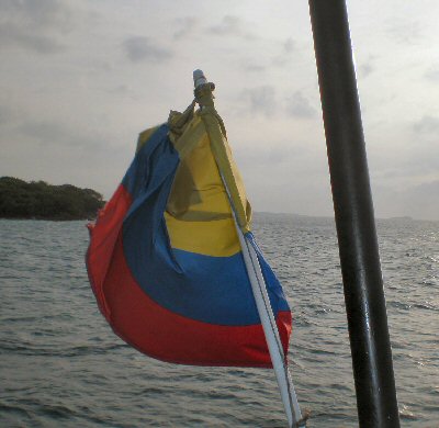
|  
      
        | Location: | 04º 38' N, 74º 05' W |  
        | Population: | 42,954,279 |  
        | Area: | (land) 401,044 sq miles (1,038,700 sq km)
 (water) 38,691 sq miles
 (100,210 sq km)
 (TOTAL) 439,735 sq miles
 (1,138,910 sq km)
 |  
        | Climate: | In 
        general terms, weather conditions are hot and humid along the coastal 
        areas, and below (1,000 m) in elevation; somewhat mild (1,000 
        - 2,000 m), and quite cold (2,000 meters, and above). The 
        hottest months are March and April; coldest months are July and August. 
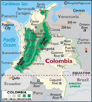
  
  As an elevation example, Bogota is over (2,500 m) in elevation, 
        and average summer high temperatures approach 78° F, while in the lower 
        eastern elevations, summer high temperatures soar into the high 90s. 
  
  Precipitation is generally moderate to heavy, with highest levels in the 
        Pacific lowlands and in parts of northeastern Colombia. Most rainfall 
        occurs from (March - May) and from (September - November). |  
        | Terrain: | Fronted 
        by the Caribbean and Pacific lowlands, as well as the eastern Amazon 
        lowlands that extend to its borders with Brazil and Venezuela, the 
        western third of Colombia is crossed by three rugged parallel ranges of 
        the Andes Mountains, namely the Eastern, Central, and Western 
        Cordilleras. 
  
  Many rivers rise in the upper elevations of the Andes, and the most 
        significant include the Cauca, Magdalena and Putumayo. The Cauca and 
        Magdalena (which flow northward) separate the three principal Andean 
        mountain ranges, eventually merging and then ending in the Caribbean 
        Sea. |  
        | Elevation: | Highest Pt. Cristobal Colon - 18,947 ft. (5,775 m) 
  
  Lowest Pt. Pacific Ocean - 0 ft. (0 m) |  |