The colonial boundaries created by Britain to delimit Uganda
grouped together a wide range of ethnic groups with different political
systems and cultures. These differences prevented the establishment of a
working political community after independence was achieved in 1962. The
dictatorial regime of Idi AMIN (1971-79) was responsible for the deaths of
some 300,000 opponents; guerrilla war and human rights abuses under Milton
OBOTE (1980-85) claimed at least another 100,000 lives. The rule of Yoweri
MUSEVENI since 1986 has brought relative stability and economic growth to
Uganda. During the 1990s, the government promulgated non-party presidential
and legislative elections.
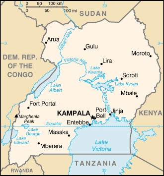
| Location: |
Eastern Africa, west of Kenya
Geographic coordinates:
1 00 N, 32 00 E |
| Population: |
28,195,754 |
| Area: |
total: 236,040 sq km
land: 199,710 sq km
water: 36,330 sq km
Area - comparative:
slightly smaller than Oregon |
| Climate: |
Tropical; generally rainy with two dry seasons
(December to February, June to August); semiarid in northeast |
| Terrain: |
mostly plateau with rim of mountains |
| Elevation: |
lowest point: Lake Albert 621 m
highest point: Margherita Peak on Mount Stanley 5,110 m |
|